
Old Ordnance Survey Inch to the Mile Maps
These maps normally cover an area of about 18 miles by 12 miles and are especially good at showing railways, roads and canals, and at giving
a broad view of a wider area. Each includes an introduction and a more detailed map of a small town or village.
They are available through our On-line Mapshop
 Here is information about Sheet 186:
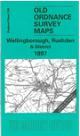
One Inch Sheet 186 Wellingborough, Rushden & District 1897 - published 2000; intro by Barrie Trinder. ISBN.978-1-84151-201-3
This One Inch to the Mile map portrays an area of east Northamptonshire and north Bedfordshire, centred on Higham Ferrers. Wellingborough is the principal town on the map but interestingly
the OS give town status to Higham Ferrers and - further east - Kimbolton, but not to Rushden. Coverage of the map stretches from Cogenhoe eastward to Kimbolton, and from Woodford and Denford southward to Castle Ashby. Railways,
apart from the Midland line, include the Northampton & Peterborough
Branch and Kettering & Huntingdon Branch. There is plentiful evidence of iron ore extraction. On the reverse we include a map of Finedon, with a commercial directory.
It is not possible to list the many hamlets, farmsteads and other topographical features shown on these maps. However, you may find it useful if we list the towns and
principal villages or church parishes that are included on this map. Links are given for those for which detailed large-scale maps are also available.
Bedfordshire: Bletsoe, Bolnhurst, Colmworth, Felmersham, Keysoe, Knotting, Little Staughton, Melchbourne, Odell, Pertenhall, Podington, Riseley,
Sharnbrook, Shelton, Souldrop, Swineshead, Thurleigh, Upper Dean, Wymington, Yelden.
Huntingdonshire: Brington, Bythorn, Catworth, Covington, Kimbolton, Leighton Bromswold, Long Stow, Molesworth, Tilbrook.
Northamptonshire: Bozeat, Broughton, Burton Latimer, Castle Ashby, Chelveston, Cogenhoe, Cranford St John, Denford, Denton, Earls Barton, Easton Maudit, Ecton, Finedon, Great Addington, Great Doddington, Great Harrowden,
Grendon, Hardwick, Higham Ferrers, Irchester, Irthlingborough, Isham, Little Addington, Little Harrowden, Mears Ashby, Newton Bromswold, Orlingbury, Pytchley, Raunds, Ringstead,
Rushden, Stanwick, Strixton, Wellingborough, Whiston, Wilby, Wollaston, Woodford.
Index maps are available showing the areas covered by the Inch to the Mile maps. Go to This page
You can order maps direct from our On-line Mapshop. For a full list of Inch to the Mile maps go to the Inch to the Mile page,
where you will also find details of prices. For information on the rest of the series, go to The Index Page.
Alan Godfrey Maps, Prospect Business Park, Leadgate, Consett, Co Durham, DH8 7PW / sales@alangodfreymaps.co.uk / 16 April 2011