
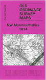
 Here is information about Sheet 232:
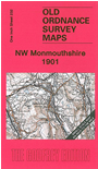
We have published two versions of this map, showing how the area developed across the years. However, the 1901 version is notable as being our first OS reprint in colour and is taken from one of the early colour-printed versions of the One Inch map. These 'Small Sheet Coloured' maps are quite rare, and map collectors as well as historians will, we think, enjoy our reprint. Please note that the coloured map costs slightly more than the rest of ther series, £ 3.50.
The maps each covers the north western part of Monmouthshire (today Gwent) with smaller portions of Brecknockshire and Glamorgan. Coverage stretches from Rhymney eastward to Llanvapley, and from Crickhowell southward to Abertillery. A major feature is the group of Valleys, with the industries and railways clustered around Rhymney, Ebbw Vale and Blaenavon; while to the east is Abergavenny with the Usk Valley. On the reverse of the 1914 version we include a map of Llechryd and Rhymney Bridge.
It is not possible to list the many hamlets, farmsteads and other topographical features shown on these maps. However, you may find it useful if we list the towns and principal villages or church parishes that are included on this map. Links are given for those for which detailed large-scale maps are also available.
Index maps are available showing the areas covered by the Inch to the Mile maps. Go to This page
You can order maps direct from our On-line Mapshop. For a full list of Inch to the Mile maps go to the Inch to the Mile page, where you will also find details of prices. For information on the rest of the series, go to The Index Page.