Old Ordnance Survey One-Inch Maps


These maps are taken from the famous OS "Inch to the Mile" Maps. Though obviously far less detailed than the large scale maps for which we are perhaps better known, they provide an invaluable overview of a wider area, typically 18 miles across by 12 miles down. For transport historians they are invaluable for showing old railways, while all historians need them for their close depiction of topography, including parish boundaries. These maps also mean that we can offer historical coverage for small villages where a large scale map would not be commercially viable. We intend to publish the whole of England and Wales in this series. Over 200 titles are now available and we aim to publish three new titles each month. The maps include historical notes and all (except the double-sided Tyneside title) also include a large scale map of a small town or village in the area.

The maps are neatly folded and each includes a specially written introduction to the area. Maps can be purchased on our On-line Mapshop where further information about titles is given. Visit the One Inch Page for a full list of Inch to the Mile Maps, or The Index Page for a full list to the series and details of Prices.

Here is information about Sheets 335 & 346:

  • One Inch Sheet 335/346 Newquay & Trevose Head 1894 - published 2009; introduction by Richard Oliver

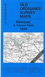
    This Inch to the Mile map includes two OS sheets, 335 and 346, and covers the north Cornish coast from Trevose Head southward to St Agnes Head, and inland to Ladock. Features include Newquay, Perranporth, Newlyn Downs, Cornwall Minerals branch, Holywell Bay, Perran Bay, Watergate Bay, etc. On the reverse we include a detailed map of part of St Agnes, including Goonlaze, Rosemundy, Peterville, Vicarage, West Kitty Mine, St Agnes church, Goonisis Mine, old shafts.


    It is not possible to list the many hamlets, farmsteads and other topographical features shown on these maps. However, you may find it useful if we list the towns and principal villages or church parishes that are included on this map. Links are given for those for which detailed large-scale maps are also available.

  • Cornwall: Colan, Crantock, Ladock, Newlyn East, Newquay, Penrose, Perranporth, Perranzabuloe, St Agnes, St Allen, St Enoder, St Erme, St Ervan, St Eval, St Mawgan, St Merryn, Zelah.

    For a full list of Inch to the Mile maps go to the One Inch Page; or for larger scale maps go to the South West page.

    You can order maps direct from our On-line Mapshop. For other information and prices, and other areas, go to The Index Page.


    The Godfrey Edition / godfreyedition@btinternet.com / 13 July 2009