
 Here are the details of maps for Milford Haven

The town of Milford was developed from the 1790s as, first, a whaling station with some shipbuilding for the navy, and later as a potential rival to Liverpool or Southampton on the transatlantic route. None of these came to fruition but by the time of our map it had become a busy fishing port.
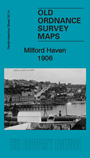
The map covers the town of Milford. Features include railway with station, mineral railway and line to Hakin, Docks, graving dock, Lord Nelson Hotel, Custom House, Victoria Bridge, Hamilton Terrace, Friends Meeting House, St Catherine's church, ruined chapel, Coombs, Pill, Gracechurch Terrace, Castle Pill, Castle Hall, Black Bridge etc. Extracts from a 1906 directory are included on the reverse.
Maps in the Godfrey Edition are taken from the 25 inch to the mile map and reduced to about 15 inches to the mile. For a full list of maps for Wales, return to the Wales page
The Godfrey Edition / sales@alangodfreymaps.co.uk / 19 February 2019