
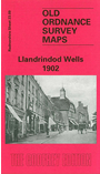
 Here are the details of maps for Llandrindod Wells:

This detailed map is double-sided for maximum coverage. The main map covers most of the town, with coverage extending northward to Brookland Road and Cae-bach. Features include town centre with individual buildings neatly shown, railway with station, Llanerch Hotel, Holy Trinity church, Hospital, Bridge Hotel, Pump House Hotel, Llanfawr, Level Crossing, chapels, Recreation Ground, River Ithon, Upper Dol-llwyn-hir, Rock Park, Pump House, Rock House Hotel, Isolation Hospital, race course, Bach-y-graig etc.
On the reverse we include a small section of adjacent sheet 23.11 extending coverage south to include Ridgebourne, Ridgebourne Arms, The Lake, Llandrindod Hall, Holy Trinity church. We also include a 1906 commercial directrory for the town.