
 Here are the details of maps for Greenock (W):

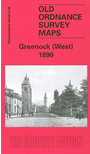
This detailed map covers the western part of Greenock, with coverage stretching from Trafalgar Street and Crawfurd Street westward to the cemetery, and from Albert Quay southward to Drumfrochar Road.
Features include part of Albert Dock, Infirmary, Cowdenknowes Reservoir; stretch of GSWR Greenock Branch, largely in tunnel, with sidings and Goods station by quay; stretch of CR Gourock Extension railway with West station; Clyde Sugar Refinery, County Court Buildings, George Square, Ardgowan Square, Caddle Hill, rope works, churches, Brewery, etc. We include directories for Ann Street, Bruce Street, Dempster Street, Holmscroft Street on the reverse.
The map links up with Renfrewshire sheet 2.06 Greenock East to the east.