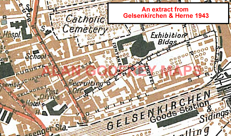
 These maps of the Ruhrgebiet and Rhineland are taken from the British War Office 1:12,500 plans and reduced to approx
1:19,000. Published in 1945, prior to the Allied occupation of the area, the maps are especially good at showing industry, collieries and transport. They are not bombing maps - indeed, they make clear that
allowance is not made for bomb damage - but show the areas with all their industrial sites and railways, largely as they were before the bombing raids of 1943-44, and have additional information added by British intelligence.
Each map includes an introduction to the area in English, with a shorter text in German. Für Informationen in deutsch.
These maps of the Ruhrgebiet and Rhineland are taken from the British War Office 1:12,500 plans and reduced to approx
1:19,000. Published in 1945, prior to the Allied occupation of the area, the maps are especially good at showing industry, collieries and transport. They are not bombing maps - indeed, they make clear that
allowance is not made for bomb damage - but show the areas with all their industrial sites and railways, largely as they were before the bombing raids of 1943-44, and have additional information added by British intelligence.
Each map includes an introduction to the area in English, with a shorter text in German. Für Informationen in deutsch.
 Our principal series ion Germany is for the Ruhrgebiet. Each map includes an introduction in English by Alan Godfrey, together with a shorter
introduction in German.
Our principal series ion Germany is for the Ruhrgebiet. Each map includes an introduction in English by Alan Godfrey, together with a shorter
introduction in German.
And this is a small companion series for Duisburg:
And this is a small companion series for Düsseldorf:
And this is a small companion series for Wuppertal:
And this is a small companion series for Cologne / Köln:
Also available, is one map in Belgium, for Huy. Follow This Link
 You can order maps direct from our On-line Mapshop.