Old Ordnance Survey Maps of Hawick


We have published more than 2,400 maps in our series of Old Ordnance Survey Map reprints; this includes more than 150 in Scotland, for most of the major towns in the country. The maps are highly detailed. They are taken from the OS 1:2,500 (or 25 inch) maps and reduced to about 15 inches to the mile. Each covers an area of a mile and a half by a mile. They show streets with individual houses, tram tracks, railway tracks and even signals, factories, wharves and such details as fountains and water troughs. They will provide hours of fascination for historians and genealogists. The maps are neatly folded and each includes a specially written introduction to the area. Maps can be purchased on our On-line Mapshop where further information about titles is given. Or visit The Index Page for a full list to the series and details of Prices.


Here are the details of maps for Hawick:

  • Roxburghshire sheet 25.07 Hawick 1897 - published 2000; introduction by John Griffiths

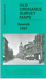
    Our detailed map of Hawick is double-sided to give maximum coverage. The main map covers the southern half of the town, with coverage from the High Street southward to Whitlaw Wood, and westward to Wilton Dean. Features include stretch of North British Railway, Slitrig Dyeworks, Stonefield Mill, Linnwood Mill, Hardie's Hill, Workhouse, cemetery, Howlands Mill, Common Haugh, Town Hall, town centre with individual buildings neatly shown, Public Park, Wilton Lodge, River Teviot, Hospital, St Mary's church, other churches and chapels, etc.

    On the reverse we include a portion of adjacent map 25.03 extending coverage northward to include Wilton, railway station, Auction Mart, Riversdale Mills, Mansholme Mills, Waverley Mills, Eastfield Mills, Glebe Mills, North Bridge etc.


    Follow this link for a complete list of our Roxburgh maps.

    You can order maps direct from our On-line Mapshop. For other information and prices, and other areas, go to The Index Page.


    Maps in the Godfrey Edition are taken from the 25 inch to the mile map and reduced to about 15 inches to the mile. For a full list of maps for Scotland, return to the Scotland page.

    The Godfrey Edition / godfreyedition@btinternet.com / 9 Dec 2010