 Here are the details of maps for Gateshead East:

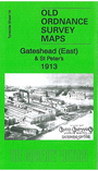
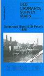
We have published two versions of this detailed map, showing how the area changed across the years. Each covers an area from Moratio Street and St Anthony's Vicarage in the north to Sunderland Road and Brewery Lane in the south.
Features on the map include Friars Goose Chemical Works, St Peters Works, Allhusen Chemical Works, St Patricks RC Chapel, Birds Nest Quarry, part of the North Eastern Railway Works, showing the Engine Sheds and Goods Sheds and Portland Cement Works. We include various directory extracts on the reverse.
The map links up with Tyneside Sheet 12 Byker to the north, sheet 18 Newcastle & Gateshead to the west, sheet 19a St Anthonys to the east, Tyneside Sheet 24 Felling to the south.
Maps in the Godfrey Edition are taken from the 25 inch to the mile map and reduced to about 15 inches to the mile. For a full list of maps for the North East, return to the North East page.
The Godfrey Edition / sales@alangodfreymaps.co.uk / 27 October 2016