
 Here are the details of maps for Wandsworth (S):

We have published two versions of this map, showing how the area changed across the years. The map covers an area south of Wandsworth, from Wandsworth Prison southward to Garratt Green, and from Earlsfield eastward to St James's Road. Features (on the 1893 version) include Earlsfield and Wandsworth Common stations, much of Wandsworth Common, Garratt Mills, a stretch of the River Wandle, Duntshill Mills, Wandsworth & Clapham Workhouse, Wandsworth Cemetery, Middlesex Lunatic Asylum (originally Surrey Pauper Asylum), St James Westminster Industrial School, Riversdale Fireworks Works, Holy Trinity church. We include street directories entries on the reverse of the 1893 map.
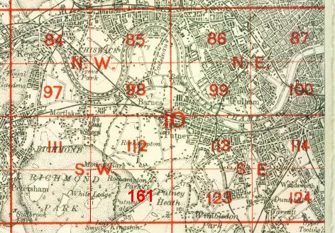
The map links up with Sheets 114 Wandsworth to the north, 123 Southfields to the west, 125 Clapham Park to the east, and 134 Tooting to the south.
 Follow this link for a complete list of our London maps .