
 Here are the details of maps for Yeading:

This map covers parts of three Middlesex parishes: Northolt to the top, Hayes to the south, and Southall in the SE. It is an entirely rural map, showing the hamlet of Yeading, with its Manor Farm and Industry pub, in the SW quarter of the map, and a stretch of the Grand Junction Canal, with various docks for the brickfields, running north-south near the eastern side of the map. On the reverse are directories for Hayes and Northolt, plus a plan of the New Patent Brick Co and its canal access.
Please note that the eastern half of this map, covering the canal area, is also included on our Greenford map.
The map links up with Middlesex Sheets 15.02 Northolt to the north, 15.07 Greenford to the east, 15.10 Southall to the south.
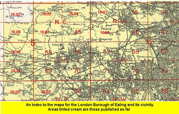 Follow this link for a list of our maps for the London Borough of Ealing, or here for a complete list of our London maps .