Old Ordnance Survey Maps of Lerwick


We have published more than 2,400 maps in our series of Old Ordnance Survey Map reprints; this includes more than 150 in Scotland, for most of the major towns in the country. The maps are highly detailed. They are taken from the OS 1:2,500 (or 25 inch) maps and reduced to about 15 inches to the mile. Each covers an area of a mile and a half by a mile. They show streets with individual houses, tram tracks, railway tracks and even signals, factories, wharves and such details as fountains and water troughs. They will provide hours of fascination for historians and genealogists. The maps are neatly folded and each includes a specially written introduction to the area. Maps can be purchased on our On-line Mapshop where further information about titles is given. Or visit The Index Page for a full list to the series and details of Prices.


Here are the details of maps for Lerwick:

  • Zetland sheet 53.13 Lerwick 1900 - published 2000; introduction by Alan Godfrey

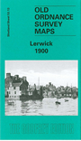
    Our detailed map of Lerwick is double-sided to give maximum coverage. The main map covers most of the town, with coverage stretching from the Victoria Pier and South Esplande westward to the Loch of Clickhimin and South Stany Hill, and from Garthspool southward to Brei Wick. Features include town centre with individual buildings neatly delineated, County Buildings, Grand Hotel, Market Stance, Clickhimin, Gilbertson Park, Freefield, Clairmont Place, Town Hall, churches, etc.

    On the reverse we include part of adjacent sheet 53.14 extending coverage eastward to include South Ness, New Cemetery, Twageos, and across Bressay Sound to the Bressay shore, incl Gunhall, Holm of Mel, Whalpa Taing.


    Follow this link for a complete list of our Shetland maps.

    You can order maps direct from our On-line Mapshop. For other information and prices, and other areas, go to The Index Page.


    Maps in the Godfrey Edition are taken from the 25 inch to the mile map and reduced to about 15 inches to the mile. For a full list of maps for Scotland, return to the Scotland page.

    The Godfrey Edition / godfreyedition@btinternet.com / 7 December 2010