Old Ordnance Survey Maps of Ayr


We have published more than 2,400 maps in our series of Old Ordnance Survey Map reprints; this includes more than 150 in Scotland, with a growing range of maps around Glasgow and the area to the SW. The maps are highly detailed. They are taken from the OS 1:2,500 (or 25 inch) maps and reduced to about 15 inches to the mile. Each covers an area of a mile and a half by a mile. They show streets with individual houses, tram tracks, railway tracks and even signals, factories, wharves and such details as fountains and water troughs. They will provide hours of fascination for historians and genealogists. The maps are neatly folded and each includes a specially written introduction to the area. Maps can be purchased on our On-line Mapshop where further information about titles is given. Or visit The Index Page for a full list to the series and details of Prices.


Here are the details of maps for Ayr:

  • Ayrshire Sheet 33.06 Ayr 1909 - published 1986; introduction by Jane MacLean

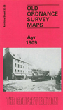
    This detailed and busy map covers much of Ayr, including the town centre. Coverage stretches from the Esplanade eastward to Craigie House, and from Tryfield Place and Hawkhill Avenue southward to the Cemetery and Bellevue Crescent. The many features include tramways, railway with station, Ayr County Hospital, Craigie Park, part of Race Course, River Ayr, part of Harbour, Low Green, football ground, Infantry Barracks, Goods station, Wallacetown, Old Church, Hotel Dalblair, Cattle Market, Burns Statue, saw mills etc. On the reverse we include a selection of street directory entries, incl Main Street, Miller Road, Newmarket Street, Sandgate, South Harbour Street, Wallace Street.

    The map links up with Ayrshire sheet 33.02 Newton upon Ayr to the north.


    Follow this link for a complete list of our Ayrshire maps.

    You can order maps direct from our On-line Mapshop. For other information and prices, and other areas, go to The Index Page.


    Maps in the Godfrey Edition are taken from the 25 inch to the mile map and reduced to about 15 inches to the mile. For a full list of maps for Scotland, return to the Scotland page.

    The Godfrey Edition / godfreyedition@btinternet.com / 7 December 2010