 Here are the details of the map for Bexhill:

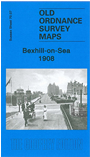
This detailed map covers the seaside resort of Bexhill, which grew from a small village into a substantial town during the 19th century; the population rose from 2,452 in 1881 to 15,330 by 1911, by which time it was the 24th largest resort in England, and had achieved some fame for its pioneering motor races on the front. Our map covers an area from the Sackville Hotel westward to Collington Wood, and from the Old Town southward to the coast. Features include the main railway with Bexhill station, also the SE&CR line with its terminus and engine shed; Egerton Park, Metropole Hotel, Kursaal, Granville Hotel, Station Square, Town Hall, tramway, St Barnabas church, Bellehill Farm, Beaconsfield Terrace. In the Old Town are St Peter's church, Manor House and Convalescent Home. A list of private residents from a 1903 directory is also included. A splendid portrait of Bexhill when it was at its peak as a fashionable resort.