 Here are the details of maps for Ledbury:

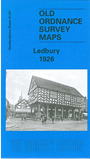
This detailed map of Ledbury covers the town in the centre of the map. Coverage stretches from Fairtree Farm in the east through to Ledbury Park in the west. From north to south is Newbury Park and the Mortuary Chapel and Cemetery. Features on the map include St Katherine's Chapel, Belle Orchard House, Fairtree Farm, Dog Hill Wood, St Michael and All Angels Church, railway line and the Cattle Market. Main streets are New Street, The Homend, High Street and Worcester Road. On the reverse is a list of private residents, with extracts from a commercial directory.