
 Here are the details of maps for Wealdstone (NW):

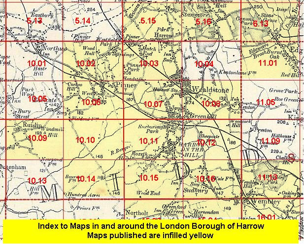
This detailed map covers the the NW part of Wealdstone, with coverage extending to Hatch End. Coverage stretches from Wealdstone High Street westward to Pinner Park, and from Boxtree Road southward to Gordon Road.
Features include stretch of LMS railway with Headstone Lane station, southern part of Hatch End, Harrow Weald area, Kodak Works, cabinet factory, Whitefriars Glass Works, Sacred Heart High School, Wealdstone House, Belmont Lodge, Headstone. The eastern half of the map especially is largely residential and all houses are neatly shown. On the reverse we include a Wealdstone directory, including private inhabitants, plus the commercial entry A-D.
The map links up with Middlesex Sheets 05.15 Harrow Weald to the north, 10.02 Pinner North to the west, 10.07 North Harrow to the south.
 Follow this link for a list of our maps for the London Borough of Harrow, or here for a complete list of our London maps .