Old Ordnance Survey Maps of Middlesex

  • These detailed maps maps normally cover an area of about one and a half miles by one mile. Each map includes an introduction. The London and Middlesex maps form a series of over 400 maps for the Greater London area. They are available through our On-line Mapshop

  • Here are the details of maps for Kingsbury:

  • Middlesex 11.05 Kingsbury & East Kenton 1932 - published 2023; intro by Pamela Taylor. ISBN.978-1-78721-660-0

    This map covers a large area of Kingsbury, recently developed in 1932, as well as the eastern part of Kenton.

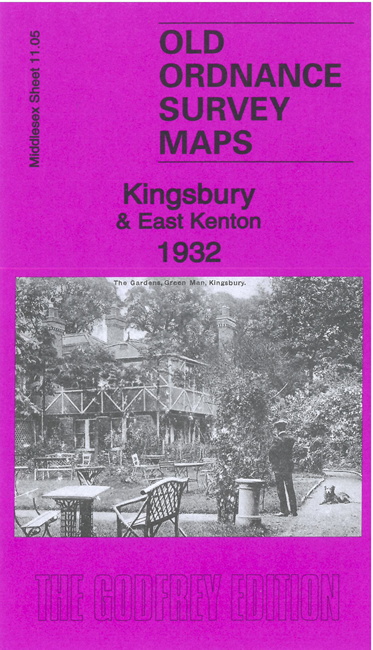
    Features include Kingsbury Manor, Valley Farm, railway (Bakerloo line) under construction, Green Man pub, maternity hospital, All Hallows RC church, Church of the Holy Spirit, Kenton Grove, and many streets of housing new at the time of the map.

    On the reverse we include extracts from a 1933 directory of Kingsbury.

    The map links up with Middlesex Sheet 11.01 Burnt Oak to the north, 10.08 Kenton to the west, 11.06 Kingsbury Green to the east, 11.09 Preston Road to the south.


  • Follow this link for a list of our maps for the London Borough of Brent, or here for a complete list of our London maps. For other information and prices, and other areas, go to The Index Page.
  • Maps in the Godfrey Edition are taken from the 25 inch to the mile map and reduced to about 15 inches to the mile. For a full list of maps for England, return to the England page.
    Alan Godfrey Maps, Prospect Business Park, Leadgate, Consett, Co Durham, DH8 7PW / sales@alangodfreymaps.co.uk / 15 June 2023