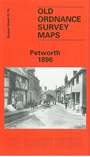
Sussex Sheet 22.16 Petworth 1896 - published 1996; intro by Peter Jerrome. ISBN.978-0-85054-786-3 
This detailed map of Petworth covers the historic town, and coverage also exctends SE to the hamlet of Byworth.
Features on the map include Petworth House, Pound Street, Market Place, Town Hall, New Street, Angel Street, High Street, St Mary's church,
Thompson Hospital, Egremont Alsmhouses, cemetery, Newgrove Farm, Shimmings, Brinksole Heath. On the reverse is a directory of
Petworth in 1899.
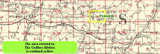
You might find this index map useful.
Follow these links for complete lists of our West Sussex and East Sussex maps.
You can order maps direct from our On-line Mapshop.
For other information and prices, and other areas, go to The Index Page.
Most maps in the Godfrey Edition are taken from the 25 inch to the mile map and reduced to about 15 inches to the mile.
For a full list of maps for England, return to the England page.
The Godfrey Edition / sales@alangodfreymaps.co.uk / 1 December 2016
 Here are the details of the map for Petworth: