
 Here are the details of the map for the Prospect Street area:

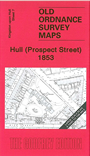
This wonderfully detailed map covers the area around Prospect Street. Coverage stretches from College Street West eastward to Bond Street, and from Liddell Street southward to Temperance Street.
Features include General Infirmary, Waltham Street Chapel, Savings Bank School, Hull Ragged & Industrial School, St Stephen's church, West Street Brewery, and many streets of terraces and courts, shown in tremendous detail. On the reverse we include extracts from an 1879 street directory for Baker Street, Brook Street, Canning Street, Charles Street, Garden Street, Portland Place, Prospect Street, Waltham Street.
The map links up with Sheets 7 Hull Prospect Street to the north and 12 Hull Old Town to the east.