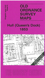
 Here are the details of the map for the Queens Dock area:

This wonderfully detailed map covers the area around and to the north of Queen's Dock, including Mason Street, Sykes Street, New George Street, Charter House, Kingston Square, Salthouse Lane, Great Union Street, part of Witham, North Bridge, Hodgson Street. Taken from an early engraved OS map it appears a little faint at first, but closer inspection finds a mass of detail, with courtyards named, and items such as timber yards, dry docks etc all shown - even details such as cranes and mooring posts - albeit for a relatively small area.
The map links up with sheets 7 Hull Prospect St to the west and 12 Hull (Old Town) to the south.