We have very good coverage for Kirklees Metropolitan Borough, which was formed in 1974 from the Dewsbury and Huddersfield County Boroughs, Batley and Spenborough Municipal Boroughs, and Colne Valley, Denby Dale, Heckmondwike, Holmfirth, Kirkburton, Meltham and Mirfield Urban Districts.
The following titles are all taken from the OS 25" maps and reduced to a scale of approximately 14 inches to the mile. Each covers an area of a mile and a half by one mile, and includes an introduction. Click on the links below for further details. All maps are available from our On-line Mapshop.
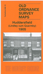 Here are the details of maps for Huddersfield (NW):

This detailed map covers the NW part of Huddersfield that includes Lindley and part of Quarmby. Coverage stretches from Bryan Road westward to Salendine Nook, and from Westbourne Road northward to Birchencliffe Road.
Features include most of Lindley, tramways, St Stephen's church (in centre of map), Plover Mills, Wellington Mills, Prince Royd, Acre Mills, Portland Mills, Oakes area, northern part of Quarmby area, Hollin's Mill, Quarmby Mills, Quarmby Fold, Weather Hill, Starkey's Allotments, Cowrakes, numerous large houses (several named) at eastern edge of map which covers part of Edgerton, chapels etc. On the reverse we include street directory entries for Acre Street, Cowrakes Road, Holly Bank Road, Lidget Street, Oakes Road, Occupation Road, Thornhill Road, West Street.
The map links up with sheets 246.11 Huddersfield North to the east and 246.14 Huddersfield West to the south