We have very good coverage for Kirklees Metropolitan Borough, which was formed in 1974 from the Dewsbury and Huddersfield County Boroughs, Batley and Spenborough Municipal Boroughs, and Colne Valley, Denby Dale, Heckmondwike, Holmfirth, Kirkburton, Meltham and Mirfield Urban Districts.
The following titles are all taken from the OS 25" maps and reduced to a scale of approximately 14 inches to the mile. Each covers an area of a mile and a half by one mile, and includes an introduction. Click on the links below for further details. All maps are available from our On-line Mapshop.
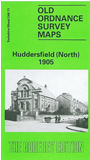 Here are the details of maps for Huddersfield (North):

This detailed map covers much of north Huddersfield, including parts of Edgerton, Birkby, Hillhouse and Fartown. Coverage stretches from Beaumont Street northward to Blackhouse Road, and from Croft House Lane eastward to Woodhouse Hall. Features include Newtown Mill, tramways and tram depot, cattle market, Albany Printing Works, Phoenix Mills, St Andrew's church, Sir John Ramsden's Canal, LNWR railway with sheds and Hillhouse Sidings, Highfield, cemetery, Edgerton, Bay Hall, Shearing Cross, Fartown cricket ground, Fartown Green, Lee Head, Cowcliffe Side, Clough House Mills, Storth, Lunnclough Hall, Marsh Fold. We have a selection of street directory entries on the reverse, incl Bradford Road, Bradford Road North, Halifax Old Road.
The map links up with sheets 246.10 Lindley cum Quarmby to the west, 246.15 Central Huddersfield to the south.